| Tuolumne Fire, Maps and Photos / photo_H-17 |
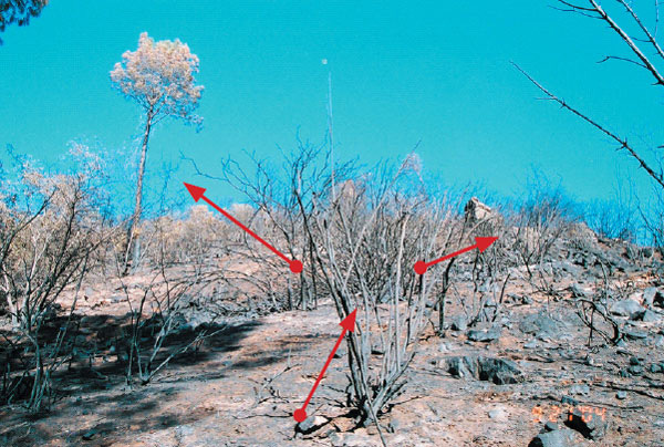
Photo H-17.
Photo taken from ridge above road and accident site, which separates the west slope and the south slope. View is up-slope with west slope to left and south slope to right. Photo shows path where fire turned up-slope/ridge (red arrows) and degree of burn. Pine tree in upper left corner shows needle freeze indicators of fire coming up-slope from this location towards it. Fuels changed in this location from leaf and needle litter with patches of brush to consistent chamise brush field to right of photo.