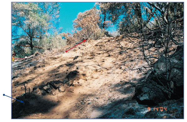
Photo H-24. Burned debris associated with Firefi ghter Schicke highest on slope located in lower left corner of photo (blue arrow). Road (red arrow) shown 23 feet above at end of dirt slope.