|
Wildland Entrapment
Fatality Fires
Download
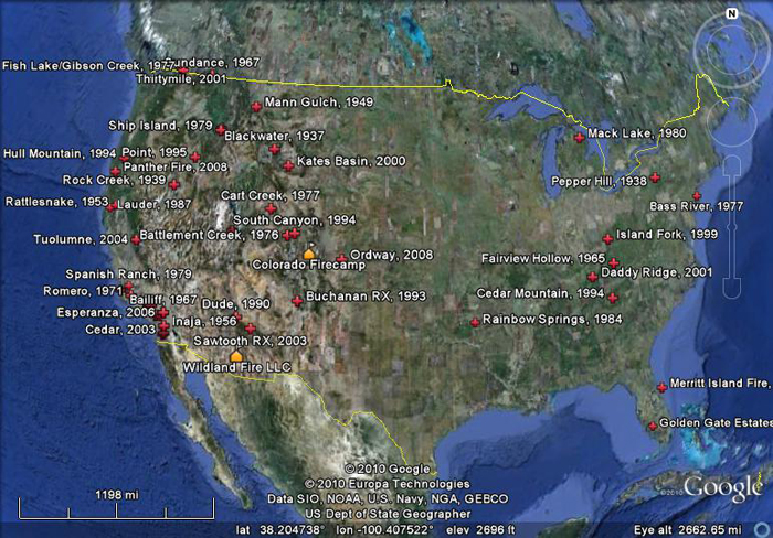
the Wildland Entrapment Fatalities
placemarks (10 kb, .kmz file)
— updated 7/7/2013 — includes
locations of 51 entrapment fatality sites with addition of Yarnell Hill Fire, 2013.
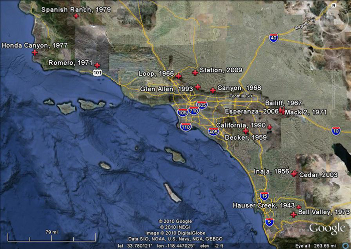
16 southern California
entrapment fatality fires.
If you have Google Earth installed, you can double-click
on the attached Placemark file and it will fly you to a location. If not,
you will need to install Google Earth first (available at
http://earth.google.com).
Google Earth streams the world over wired and wireless networks
enabling users to virtually go anywhere on the planet and see places in
photographic detail. This is not like any map you have ever seen. This
is a 3D model of the real world, based on real satellite images combined
with maps, guides to restaurants, hotels, entertainment, businesses and
more. You can zoom from space to street level instantly and then pan or
jump from place to place, city to city, even country to country.
Get Google Earth. Put the world in perspective.
|